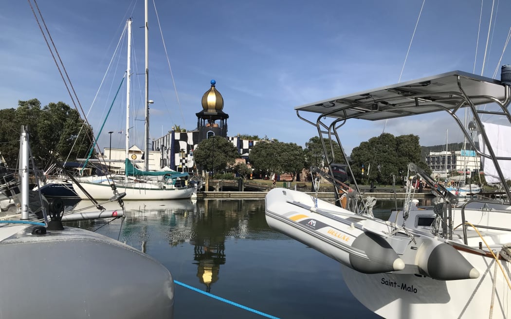
New Zealand's $33 million Hundertwasser Art Centre looks over boats, only metres from the Whangārei Town Basin where sea level is predicted to inch ever higher. Photo: LDR/Susan Botting
Northlanders are being encouraged to take photos of this week's king tides in a citizen scientist project to help monitor the impact of sea level rise into the future.
Northland Regional Council (NRC) is asking for people to take local photos of the effects of king tides from 11-14 March, uploading them to its website.
Photographers upload the photos from around the highest tide time to the council website, where they are also added to a map of the region to show what is happening where.
The council is seeking king tide photos from Northland's east coast from 11-14 March and west coast on 11 and 12 March.
NRC said the citizen scientist photography had an important role in data monitoring and collection, and built a useful pool of local knowledge.
"Your photo may help us identify areas that are already at risk from higher water levels," the NRC website said.
The photos would be used to observe, visualise and understand the impacts of future sea level rise on coastal communities, help document current coastal flood risks, validate climate change models, and serve as a living record of change for future generations.
Members of a Whangārei cancer Monday morning walking group, who were walking the Town Basin loop, said on Monday tides were definitely rising.
"The tides are getting higher at Kissing Point," Peter Attwood said.
Tūtūkākā tides were also doing the same, Keith Whalley said.
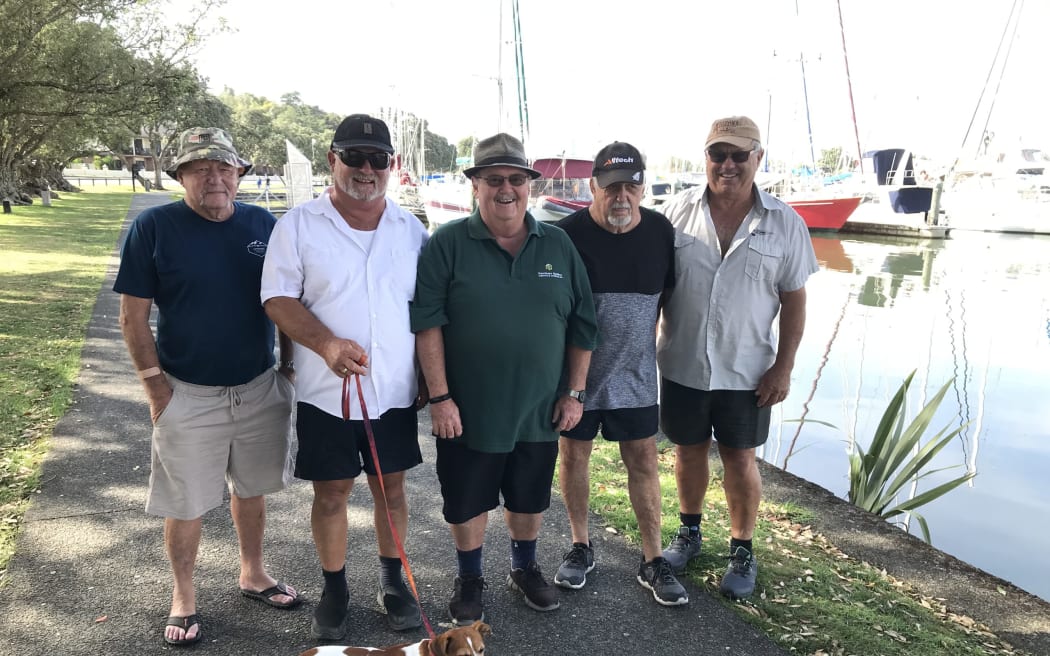
Whangārei Monday cancer walking group members (from left) Max Atkinson, Keith Whalley (with dog Missy), Peter Attwood, Tony Williams and Bill Gibbs walking the Town Basin loop during Monday's king tide. Photo: LDR/Susan Botting
The men, who are also former boaties, walk the Town Basin loop weekly and were there at the 9.28am king high tide on Monday.
Members said photographing the impacts of those tides was a great idea.
Meanwhile, Town Basin German yachties Andre and Hannah Waidelich, who live on their 10-metre yacht, said it was important councils ensured their infrastructure could deal with the challenges of king tides in a sea level-challenged future. Germany was also experiencing similar issues, the couple said.
King tides and their effects were visible locally and across the ocean.
The couple said the impact of sea level rise was clear throughout their travels, including in the Tuamotu Islands in French Polynesia where the biggest high tides were already threatening some of the group's about 80 islands and atolls.
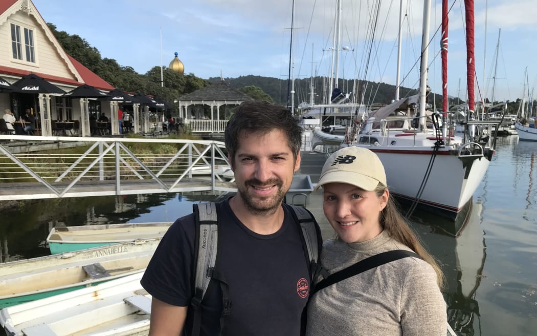
Town Basin yachties Andre and Hannah Waidelich during Monday's king tide. Photo: LDR/Susan Botting
King tides are the highest high tides of the year that happen roughly every seven months.
This year's autumn king tides are over several days in January, February, March and April when the sun, moon and Earth align to create strong gravitational pull on the ocean. They happen when the full or new moon coincides with the time when the moon is closest to Earth in its monthly orbit.
Climate change and sea level rise amplifies the height of these king tides.
"When king tides occur during floods or storms, water levels can rise even higher and have the potential to cause great damage to the coastline and coastal property," the NRC website said.
"King tides give us a glimpse into the future of what Northland's coastline may look like as a result of sea level rise," NRC's website said.
"This is because as sea levels rise, the highest high tides will become even higher and reach further inland.
"We want to understand how higher sea levels resulting from climate change could impact Northland's coastline and sharing photos of local king tides will help understand and plan for this."
Next month, the council is wanting photos from the east coast on 9-11 April and west coast on 9-10 April. In May it is wanting photos from the east coast only, from 8-10 May.
LDR is local body journalism co-funded by RNZ and NZ On Air.
![Leithfield Beach . . . The community of 245 houses could be under threat from future sea level rise. Photo: David Hill / North Canterbury News [LDR single use only]](https://media.rnztools.nz/rnz/image/upload/s--byUinVa9--/ar_16:10,c_fill,f_auto,g_auto,q_auto,w_288/v1705440487/4KW9R17_Hur1078LDRcoastal1_scaled_jpg)