By Jamie Morton of 
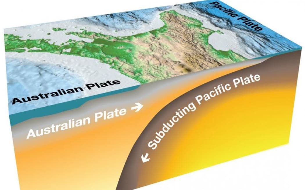
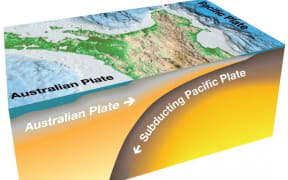
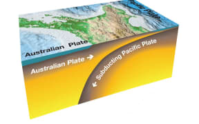
The Hikurangi subduction zone is where the Pacific tectonic plate subducts - or dives underneath - the Australian tectonic plate. Photo: Supplied / East Coast LAB
It is capable of unleashing "mega-thrust" earthquakes and tsunamis, the like of which New Zealand has never experienced in modern times.
Now, scientists have revealed how our largest fault - the sprawling Hikurangi Subduction Zone - moves.
A major study, published this morning, sheds fresh light on the mysterious processes behind silent "slow-slip" earthquakes now understood to be massively influential along the vast boundary.
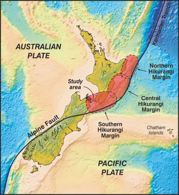
On a map, this system appears as a long line curving from waters well north of the East Cape to the northeastern South Island, beneath which the Pacific plate dives - or subducts - beneath the Australian plate.
The constant mashing together of these two vast chunks of the planet's crust produces an enormous amount of pent-up energy that must be somehow released.
The "mega-thrust" subduction zone earthquakes behind the 2004 Indian Ocean tsunami - and the catastrophic Tōhoku disaster in Japan seven years later - show how, in extremely rare cases, this can happen in the worst possible way.
Geologists now have evidence for subduction earthquakes that happened on the southern part of the Hikurangi Margin. Photo: GNS Science
Along our own subduction zone, scientists have estimated a 26 percent chance of an event with a magnitude of 8.0 or larger striking beneath the lower North Island within the next 50 years.
That's underscored the importance of a major research focus on the role of slow-slip earthquakes, which unfold along the boundary silently, yet pack the power to shift faults by tens of centimetres over days, weeks or months.
Their occurrence didn't necessarily mean Hikurangi's next big shake was on its way, with the vast majority of events transpiring without ensuing ruptures - and often helping relieve pressure slowly.
They're known to occur at shallow depths off the East Coast, but also at deeper levels off Manawatū and Kāpiti regions, where one ongoing event recently released pent-up energy equivalent to a 7.0 quake.
In other parts of the boundary, however, the plates are "stuck" - or locked together and constantly building up pressure.
By understanding the structural factors that create the smoother "slipping" and "stuck" zones, scientists eventually hope to pinpoint those areas that could trigger major quakes and tsunamis in the future.
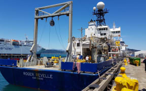
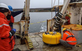
The latest study, published in the journal Science Advances, arose from a 2018 survey off the coast of Gisborne, in which an international team of scientists used special seismic equipment to gather richly detailed imagery of the zone's northern margin.
These three-dimensional, Cat-scan like images have yielded a trove of insights about how the fault moves - and perhaps most importantly, how fluids are trapped and transported within it.
Generally, scientists believe the make-up of the Earth's crust is a major factor in how tectonic energy is released, with softer, wetter rocks allowing plates to slip slowly, and drier, brittle rocks storing energy until they fail in violent and deadly mega-quakes.
Along our subduction zone, however, a wide variety of quakes are routinely observed - something thought to largely owe to the effects of fluids on the plate boundary.
Previously, scientists had singled out a mechanism that "hydrated" the subduction zone's faults and made them weak - yet they still had not pinpointed what kept the fluids in place over periods of tens of thousands of years.
The same survey in 2018 identified a potential answer in seamounts: huge underwater mountains that stretch from the ocean floor without reaching the surface.
Their 3D scans, reported in a June study, also found evidence to suggest that these fluids remain trapped in a trough made as seamounts pass their way through the subduction zone, allowing the fault to be weakened over many earthquake cycles.
Their images showed the Pāpaku Seamount - a long-extinct volcano lying kilometres beneath the sea floor, east of the North Island - colliding with the subduction zone, amid a pattern of stresses, fluids and sediments.
While earlier models suggested sediments were pushed down the subduction zone ahead of the seamount, the scan revealed something different: an enormous sediment trail in Pāpaku's wake.
In another surprise, the scientists spotted the fading trail of a much larger seamount that had long since sunk beneath New Zealand's North Island.
The discovery suggested that sinking seamounts drag down enough water-rich sediment to create conditions in the crust suitable for slow-slip earthquakes, at least in New Zealand.
Another recent paper also revealed a previously hidden water reservoir within the layers of the Pacific plate being swallowed up in the subduction process.
The findings published today added more clarity to the picture, by suggesting that the subducting plate was acting as an "amplified source of water" that influenced the slip behaviour of the margin.
By being trapped and under pressure, this water in turn helped weaken the plate boundary, making it more prone to unlocking and sliding in slow slip.
"Importantly, we are able to pinpoint the location of water-rich layers, that allow smooth slipping, versus other water-poor segments that are stuck and will likely rupture in fast earthquakes," said the project's lead, GNS Science principal scientist Dr Stuart Henrys.
The wealth of new data about the subduction zone's physical conditions and rock properties was also expected to help scientists understand what sort of ground-shaking and tsunami impacts could come with future ruptures.
"The results published today represent another piece in the subduction puzzle that we can start using in large-scale earthquake cycle simulations that greatly help improved hazard preparedness and response."
Scientists have now begun modelling the effects of trapped fluids on mega-thrust earthquakes all the way through to the Kermadec subduction zone, with plans to extend the work to the entire southwest Pacific.
This, it is ultimately hoped, will lead to new physics-based models able to calculate tsunami hazards for all of New Zealand's local and regional earthquakes.
This story was originally published by the New Zealand Herald.