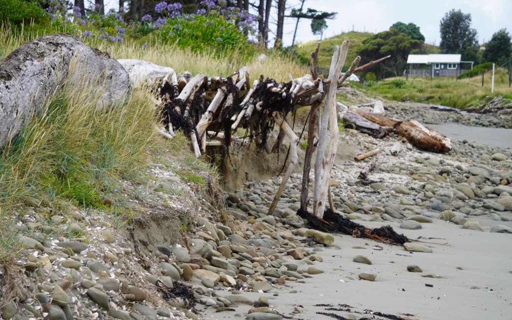
Erosion at the northern end of Mahanga Beach after Cyclone Gabrielle. Photo: RNZ/Kate Green
New research a year on from Cyclone Gabrielle shows parts of the East Coast's shoreline are the most eroded they have been in decades.
Scientists at the University of Auckland have found parts of the coast have more than 10 metres of erosion, and in the case of Mahanga Beach north of Māhia, 20 metres was carved away.
The focus now is on whether they will get it back.
Associate professor Murray Ford said his team had been mapping the coast's changes over the past 80 years, collecting historical aerial photos and comparing them with modern images, funded by the government's Resilience to Nature's Challenges - National Science Challenge.
In the cyclone's aftermath, they immediately began acquiring more satellite images to compare the before and after.
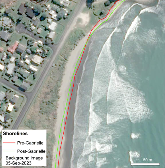
Photo: Supplied / Airbus DS 2023
Mahanga Beach was particularly affected.
"It's a big long sandy beach, but most of the erosion seems to be focused at the northern end," Ford said.
"They've got a bit of a buffer between the beach and the road and houses, but that's now down to 20 metres in places, whereas 18 months ago it was twice that width."
The storm surge caused huge waves which carried sand off the beach and out to sea. Most of the erosion happened during a single high tide, over the space of hours.
"What happens when a storm typically passes through is you get instantaneous erosion, and then it takes a long time for the beach to recover. Given we've lost a lot of dune, it takes a long time for that sand to make its way back up onto the beach and build the dune back out as a healthy buffer."
Would it build back up again? Ford said it was too soon to tell.
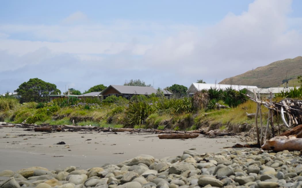
At Mahanga Beach, the dunes separate the beach from the road, with houses on the opposite side. Photo: RNZ/Kate Green
"It could take years to decades, if it follows what we see with similar events overseas."
Ford said he hoped the research would inform councils' mandatory hazard guidance for households, such as how close people could build to the shore and floor heights for new builds.
"We're trying to quantify how much you can actually lose in a particular event so they can come up with better setback zones for coastal properties."
Homes were not yet under threat at Mahanga Beach, Ford said.
"The amount of erosion we saw from this particular storm is not outside the bounds of what's expected in that guidance, but as sea level rises, the waves can access the dune more frequently, and we'd expect to see an increase in the rates of erosion."
In many cases, that was factored in to the councils' advice, but there were also many communities built before the guidance was made.
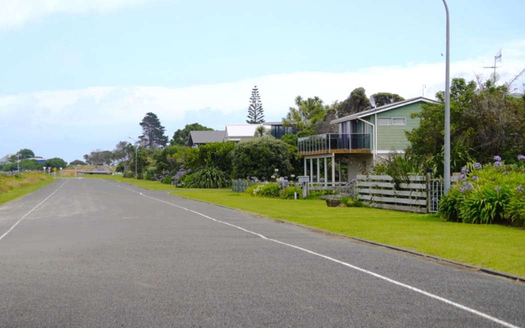
Homes along the road closest to Mahanga Beach are not yet under threat. Photo: RNZ/Kate Green
As part of the research, the team set up a Facebook page where locals could submit their own pictures and got boots on the ground, doing drone surveys.
The extent of Gabrielle's erosion made it a standout case, with considerable erosion from Northland down to Hawke's Bay.
But advances in technology meant access to high-resolution satellite imagery was easier now than ever, Ford said.
"Commercially, they've been operating these very high resolution satellites for about the last 20 years, but it's probably only been over the last four or five years that the cost has come down, and the accessibility got to the point where you can order an image on your phone... or you can actually pay a little bit more and task a satellite to be over your beach at a particular time and take an image."
He said it cost academic buyers about $20 per square kilometre. The higher the resolution, the higher the cost, but it was a gamechanger for scientific research, he said.