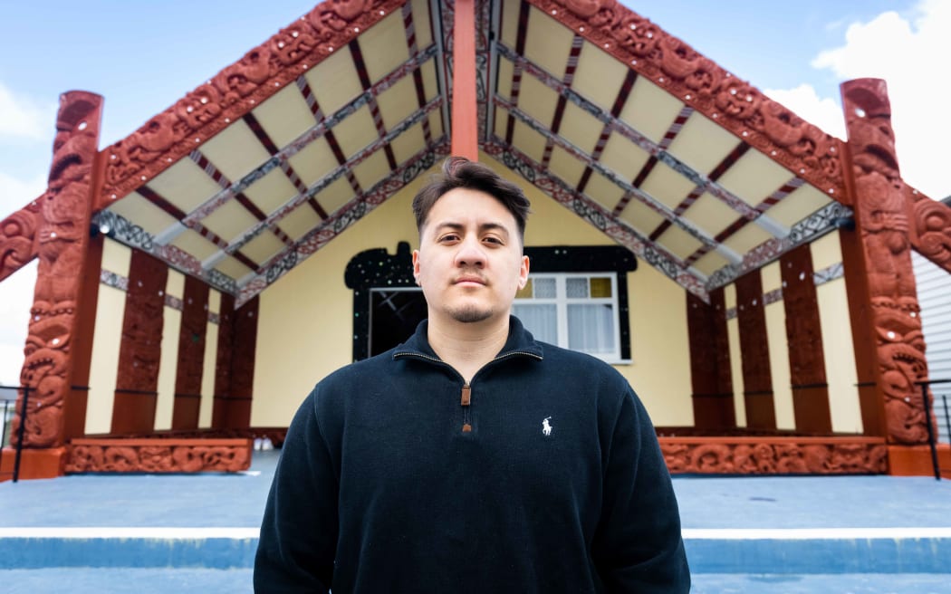
Haukapuanui Vercoe conducted an analysis of 869 marae nationwide to identify the marae that were at risk from natural hazards. Photo: Trinity Thompson-Browne
Hundreds of marae around the country face potential exposure to floods, landslides and other natural hazards, but new research aims to bolster marae resilience in the face of climate change.
University of Auckland Engineering PhD student Haukapuanui Vercoe conducted an analysis of 869 marae nationwide using geographic information system (GIS) mapping to identify the marae that were at risk from natural hazards.
His findings show that one in three marae are in flood prone areas, 20-30 percent are prone to landslides, 10-20 percent are in tsunami evacuation zones and 30-40 percent are susceptible to liquefaction in the event of an earthquake.
"The intended outcome of this is rangahau (research) is to provide hau kainga with the data and tools to aid in their decision-making. In this way, they can create visualisations of potential impacts to the marae directly, key infrastructure and other places of significance such as wāhi tapu or historic pā sites," he said.
Marae locations are added to the GIS mapping software, datasets for floods, landslides and other natural hazards can then be overlaid, Vercoe said.
He said no hazard model was perfect as they were based on a range of underlying assumptions, but when combined with the knowledge of the haukāinga, the locals, they showed a much clearer picture.
"We provide what we can with the available datasets, but we are also fortunate that marae have shared their mātauranga with us relating to natural hazards. By dovetailing these plural knowledge systems, it enhances the resolutions of the data, which then strengthens the marae emergency preparedness plans."
In October of last year they partnered up with Te Arawa Lakes Trust to roll out emergency preparedness plans for 26 marae in the Rotorua region.
Vercoe said that included creating hazard maps tailored to the marae, as each marae faced different risks.
"Some marae may not want to relocate if they are in those tsunami evacuation zones for example, they might want to stick to that place and kei te pai tērā. It's up to each marae and there's no one size fits all solution, I guess what we're doing is providing some information so that they can make the decision for themselves."
Vercoe said marae provided crucial support to the community during natural disasters but were often under resourced relying on koha and grants to cover expenses.
"I think instead of calling our people resilient what we really need is investment. That's one of the findings from some of the Cyclone Gabrielle rangahau (research) was that they always say our people are resilient... but really what the community needs is investment so that the level of service that our marae can provide can be much higher."
If marae had better infrastructure in place, such as on site water tanks, back-up genarators, solar panels and Starlink, they would be even more effective at responding to natural disasters, Vercoe said.

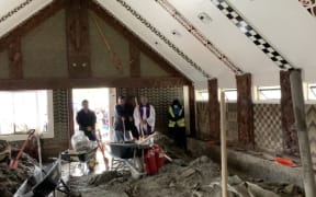
Tangoio Marae in Te-Matau-a-Maui was left blanketed with 2.5 metres of silt when Cyclone Gabrielle hit in February 2023, after the river behind it breached its banks, sweeping logs into buildings. Photo: Supplied / Tangoio Marae
Putting a plan in place
In Maketū one marae has already developed its own Climate Plan.
Whakaue Marae sits on the edge of the Maketū estuary, its wharenui is at risk from both erosion and flooding.
Kaiwhakahaere for Te Rūnanga o Ngāti Whakaue ki Maketū Roana Bennet said they did not feel included in local and central government climate plans so they developed their own.
"In a natural disaster people naturally look to the marae, look to the iwi for leadership. So why not look to the marae and the iwi for leadership without the disaster so we can do the planning and bring everyone along to where we need to be to be safe."
Bennet said the Maketū community had embraced the plan and the iwi recognised they could not do it alone.
She said the wharenui would be moved if the worst should happen, but even if the marae was no longer liveable the iwi would not retreat from its katiaki obligations.
"There is a lot of pushback in our community around the term managed retreat, we reject that concept of retreating from a place where we've been kaitiaki for over 800 years."
It was essential that iwi were given the space to lead out on these climate plans, Bennet said.