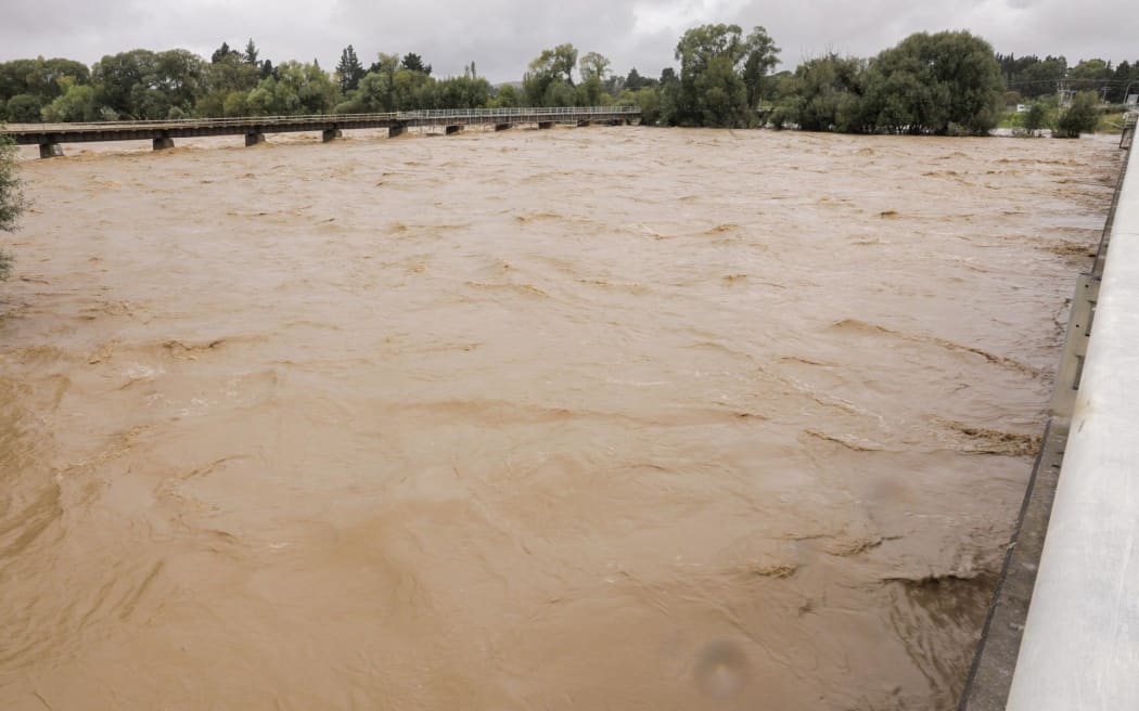
The Wairoa River. Photo: Hawke's Bay Civil Defence
The plea comes as the Wairoa River burst its banks and flooded an area that is home to half the town's population.
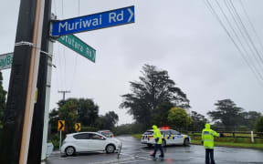
Wairoa is situated between Napier and Gisborne and it remains completely cut off.
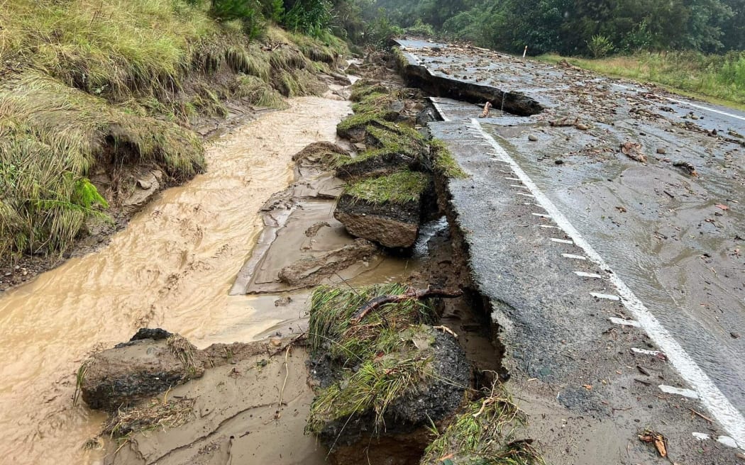
Photo: Waka Kotahi
Hawkes Bay Emergency Management said the town of 8000 has no power or telephone service, no drinking water supply, and very limited amounts of food.
It said the town was cut off by a damaged bridge to the south and impassable roads to the north.
Emergency Management Minster Kieran McAnulty said he was "really concerned" about the town, which remained in a complete communications black-out.
Regions like Tairāwhiti have been able to communicate via satellite phone in lieu of cell towers being down in bad weather.
But McAnulty said this was not the case for Wairoa.
Hawke's Bay Emergency Management has advised residents in parts of the coastal suburb of Haumoana to evacuate.
It said high tides and swells have prompted the precautionary measure, which affects an area north of the intersection of Shrimpton and Beach roads.
Napier City Council has also told residents of about 30 homes to evacuate because a nearby stop bank has burst.
It said people at numbers 210 to 274 Te Awa Avenue should evacuate and residents of Hunter Drive should be on high alert.
Meanwhile, Hawke's Bay Civil Defence said it could not cope with the scale of damage in the region and has asked for help from the National Emergency Management Agency.
MetService has issued an orange heavy rainfall warning for Hawke's Bay and officials said rivers are still extremely high and conditions were hazardous.
Napier Airport has had its second wettest day since 1950.
— MetService (@MetService) February 13, 2023
Between 9am Monday and 9am Tuesday, there was 175.8mm of rainfall.
The average amount of rain they get in all of February is 56mm. pic.twitter.com/v9faIY0svJ
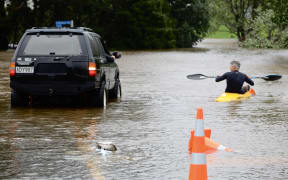
Several rivers have burst their banks and flooding has prompted evacuations and road closures as well as roof-top rescues from homes near the Tutaekuri River between Taradale and Hastings.
The local emergency management group said Hawke's Bay was reeling from the effect of Cyclone Gabrielle and it was grappling to gain a full understanding of the situation.
It said the failure of cellphone towers has severely limited information flows.
New information was still being received and emergency services were making foot patrols and rescues.
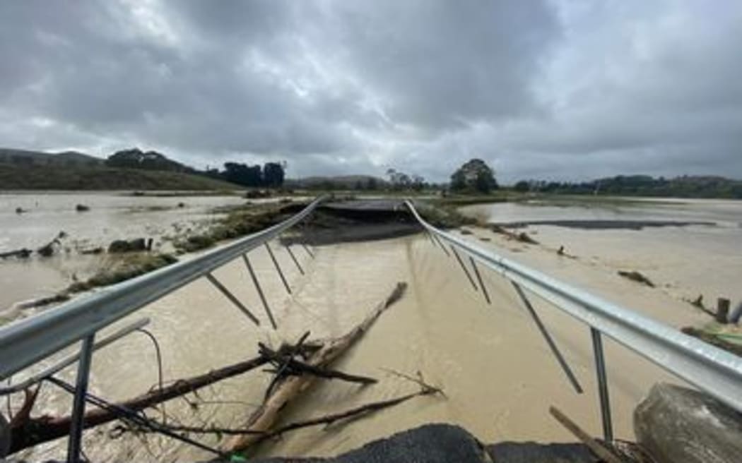
The Waikare Bridge at Putorino on SH5 Napier-Taupō. Photo: Supplied / Tony Alexander
Concern over other rivers
The Waipawa and Tukituki Rivers have topped their banks, and there was a high probability of the stop bank failing with continued rainfall, officials said.
The Waipawa River Photo: RNZ / Angus Dreaver
The Ngaruroro River overtopped its banks earlier today, resulting in the evacuation of Ōmahu. Taradale and parts of Meeanee were evacuated given the level of the Tutaekuri River, however that alert was lifted at 4pm and residents were advised they could return home.
A number of bridges remain impassable, including Fernhill Bridge (Ōmahu), Vicarage Road (Puketapu), Waiohiki (Taradale) and Brookfields Bridge (Meeanee) and the Esk Bridge north of the SH2 intersection with SH5.
Waka Kotahi has closed the bridges on SH2 due to safety concerns. Combined with roads being blocked due to flooding and trees, Napier and Hastings are now isolated from each other.
The Hastings and Napier drinking water supplies remain operational but with the community asked to restrict their use to reduce the impact on the wastewater network.
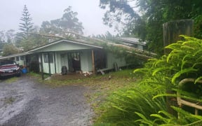
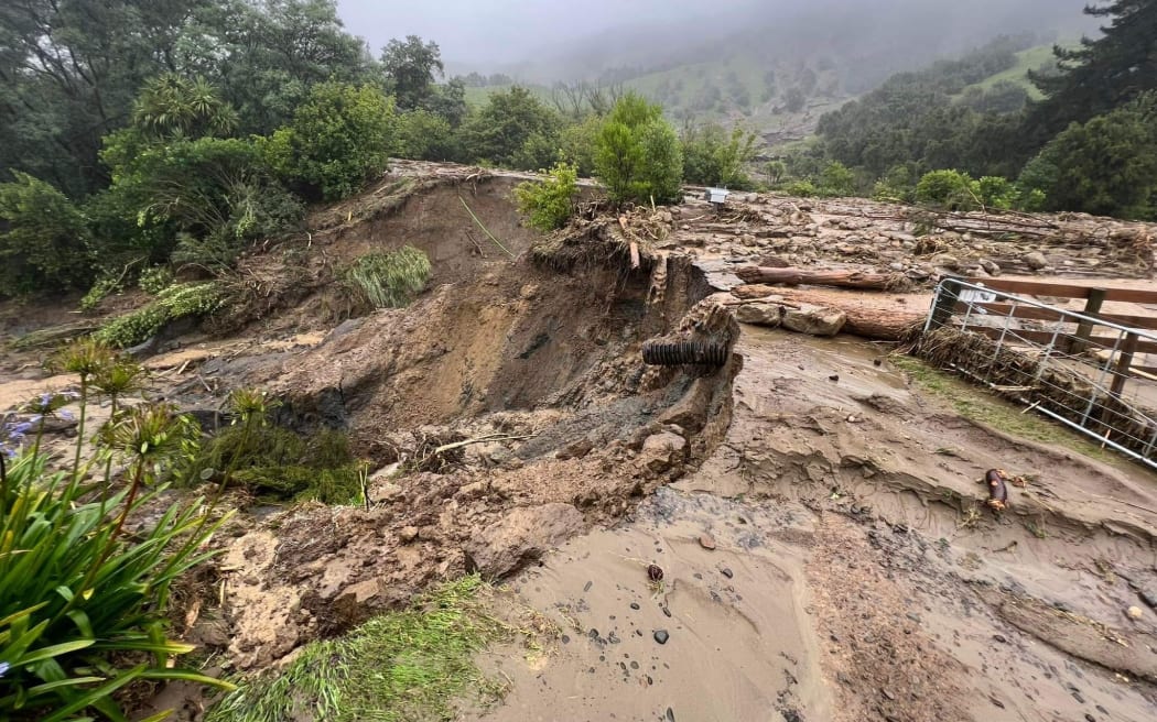
Eskdale Valley has been particularly hard hit by the cyclone, with extensive damage. In addition to evacuation orders and self-evacuations, a number of rescues have been undertaken by emergency services.
Hawke's Bay Civil Defence controller Iain Maxwell said the cyclone's impact was yet to be fully understood.
"Our focus continues to be on people and safety, and making sure those who have lost their homes have somewhere warm to be, food and water. The rest of us need to be resilient; looking after ourselves, our families and our neighbours.
He said the recovery time will be lengthy because it has unfolded as "an unprecedented natural disaster".
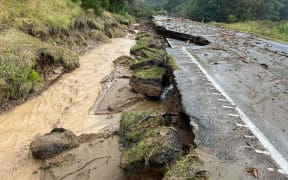
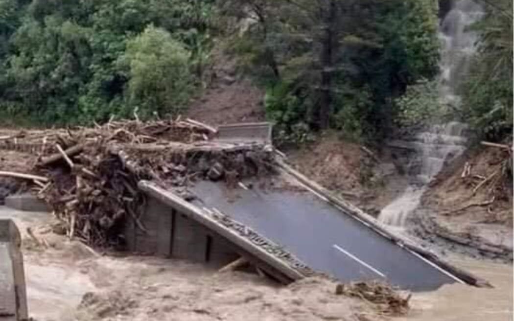
Parts of the Napier-Taupō Road, or State Highway 5, have been destroyed by Cyclone Gabrielle's fury.
Part of the Napier-Taupō Road bears the scars of Cyclone Gabrielle. Photo: Supplied / Tony Alexander
Cyclone damage on the SH5 Napier-Taupō highway. Photo: Supplied / Tony Alexander
Phone and electricity was cut off during much of the day and the District Council in Taupō sent in a chopper to see how the rural community has fared.
Taupō District Councillor Kylie Leonard said there were concerns for people's welfare.
She said it will take some time to restore power and clear the many slips across roads linking Taupō and Hawke's Bay.
National state of emergency: What you need to know
- The New Zealand government has declared a National State of Emergency, to assist in the response to Cyclone Gabrielle.
- The declaration will apply to the six regions that have already declared a local State of Emergency: Northland, Auckland, Tairāwhiti, Bay of Plenty, Waikato, and Hawke's Bay.
- A national state of emergency gives the national controller legal authority to apply further resources across the country and set priorities in support of a national level response.
National Emergency Management Agency advice:
- Put safety first. Don't take any chances. Act quickly if you see rising water. Floods and flash floods can happen quickly. If you see rising water do not wait for official warnings. Head for higher ground and stay away from floodwater.
- Stay at home if it is safe to do so. But have an evacuation plan in case your home becomes unsafe to stay in.
- If you have evacuated, please stay where you are until you are given the all-clear to go home.
- People should stay up to date with the forecasts from MetService and continue to follow the advice of Civil Defence and emergency services.
- Do not try to walk, play, swim, or drive in floodwater: even water just 15 centimetres deep can sweep you off your feet, and half a metre of water will carry away most vehicles. Flood water is often contaminated and can make you sick.