West Coast Emergency Management is pre-positioning staff and resources ahead of a forecasted deluge.
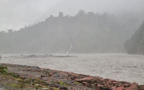
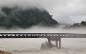
MetService has placed the West Coast under an orange heavy rain warning until Thursday night with up to 800 millimetres expected to accumulate in places.
The region's group manager, Claire Brown, said staff were constantly getting updates on the situation.
"We're starting to pre-position resources around the district so that we know we've got the people in the right place," she said.
"There are some other resources in terms of generators located and we're also working closely with our critical infrastructure agencies, such as Chorus and the Transport Agency (NZTA), ensuring they are making their own preparations in the event that there is any interruption or impact on their services."
Staff on the ground were giving regular updates of the conditions where they were, as well as monitoring river levels and the latest forecasts, Brown said.
She was based in Greymouth and said rain was yet to fall there, though the sky was "grey and heavy".
"We understand the rain has already begun down in the Westland District and is already having some effect on the river catchment, so we're expecting that to continue over tonight and into tomorrow," Brown said.
"It's pretty persistent [now until Thursday]. We're hoping that it might let up a little bit into Wednesday evening but certainly between now and then the rain will be heavy."
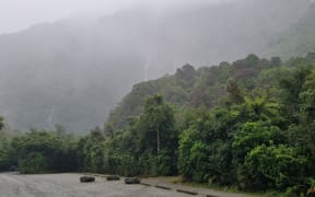
Franz Josef on Tuesday afternoon. Photo: RNZ / Nate McKinnon
The forecast rain was a huge amount, even for the West Coast, she said.
"We're accustomed to large amounts of rainfall, that's the nature of the environment we live in."
But it's important people were not complacent and took the warnings seriously, Brown said.
"This is happening over a number of days, over quite a large area, so it's really difficult to pinpoint any particular area or time [of concern].
"We're encouraging everyone to keep up to date with the weather forecast and before you leave home, check the roading conditions, check that everything is okay where you're travelling," she said.
People should also have some emergency supplies in their vehicle if travelling through or around the region in case they got caught out or stuck somewhere unexpected.
This should include warm clothes, some food and water, Brown said, and it was good practice to always carry it.
"Up to 800mm of rain over that period of time is a significant amount of rain, so we're asking people to take every precaution."
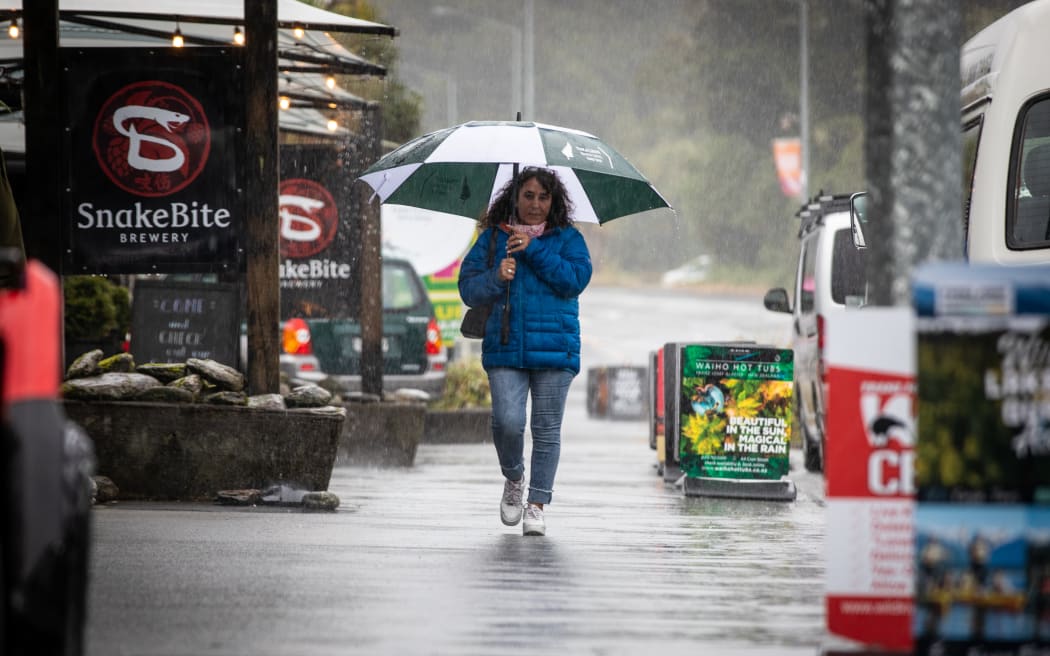
Rain already falling
MetService said more than 100mm of rain has already fallen in Milford Sound.
Forecaster Gerard Bellam said the front had hit the Fiordland and was slowly beginning to move into Westland.
"We've seen that rain set in this morning with heavy falls registered - already we've had 117mm recorded at Milford Sound, so certainly, the train is rolling through now," he said.
Rapid lake and river level rises were expected, Bellam said.
"We're going to see quite a lot of spill over from the West Coast into those Otago and Canterbury headwaters.
"People need to be alert and keep up to date with the latest warnings and watches. Rivers in the eastern parts of the South Island will certainly be rising rapidly," he said.
Wind gusts of 179 kmh had also been recorded in exposed, high altitude areas in the Canterbury High Country, Bellam said.
The heavy falls were set to stick around for most of the week because a large high sitting out near the Chatham Islands was blocking the front's normal progression across the country, he said.
Great walks closed
The Department of Conservation had closed several Great Walks and tramping tracks in the South Island as heavy rain bore down.
In Fiordland, the Milford and Routeburn tracks were closed, and anyone on them would remain at the huts with rangers until they reopened.
The Hooker Valley Track in Aoraki Mount Cook National Park was also shut until the weather had cleared and staff could check the swing bridge and track.
"Four-wheel-drive access into the Ball had also been closed," Western South Island Regional Operations Director Mark Davies said.
Visitors booked to stay in those huts between today and Saturday had been contacted and had their booking refunded, he said.
On the West Coast, the Paparoa Track was set to close between the Smoko Carpark and Pororari hut overnight on Thursday.
The Kepler Track remained open but people could request a refund if they wanted, Davies said.
"NIWA provides DOC with 12, 24, 36 and 48-hour updates about severe weather," he said.
"With an impending severe weather event - such as that forecast for this week - Visitor Centre staff use the DOC booking system to notify booked visitors 24-48 hours ahead of the start of their trip so they know tracks are closing.
"There are also closure alerts on individual track pages on the DOC website," Davies said.
Closures were being reassessed on Wednesday.