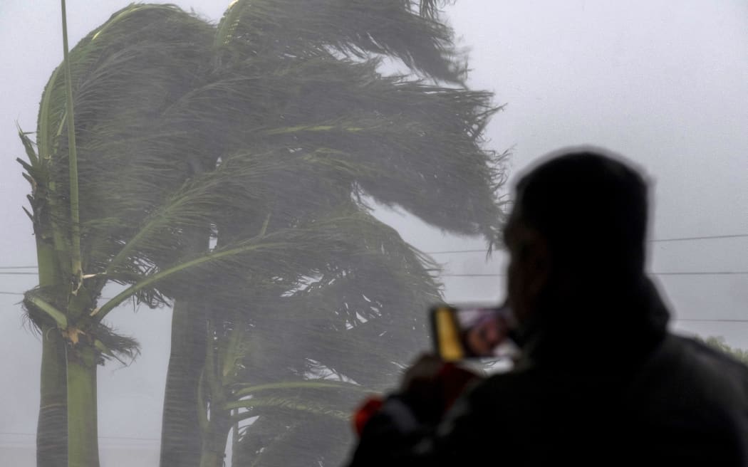
A man livestreams as Hurricane Ian hits Punta Gorda in Florida. Photo: AFP
Hurricane Ian on Wednesday began lashing Florida's Gulf Coast with powerful winds and drenching rain, prompting authorities to tell residents it was too late to evacuate as the eye of the storm reached shore with close to Category 5 power.
Southwest of Punta Gorda, Florida, Ian delivered sustained winds of 250km/h, the US National Hurricane Centre said.
That was just shy of a Category 5 designation, though Ian was expected to weaken a notch after hitting land, the centre said.
At noon (US time), the centre said the storm's eyewall, just outside of the centre, was moving on shore at Sanibel and Captiva islands, which form a barrier to the west of Fort Myers. It also issued a rare "extreme wind warning" that could signal the approach of a tornado there.
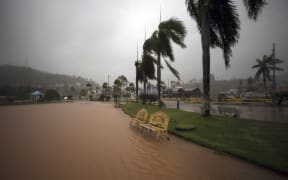
In Venice, a coastal city of nearly 24,000 residents, halfway between Tampa and Fort Myers, rain and wind were already intense before noon. Many streets were flooded, and the steady gale bent palm trees at 45 degree angles and shredded billboards and road signs.
#HurricaneIan has made landfall as a Cat 4 storm, expected to move over central Florida tonight & Thursday morning. We're standing by on the ground to support sheltering & provide relief efforts. ⛑
— American Red Cross #HurricaneIan (@RedCross) September 28, 2022
For local updates, follow:
@RedCrossCFL
@SFLRedCross
@RedCrossNorthFL pic.twitter.com/guLdx0rpBb
Forecasters said Ian would unleash wind-driven high surf, torrential rains that may cause storm surges of up to 3.7 metres along with intense thunderstorms and possible tornadoes. The storm's outer bands were already bringing heavy winds and rains to much of the Gulf Coast on Wednesday morning.
"I wish this wasn't a forecast that was about to come true. This is a storm that we will talk about for many years to come, an historic event," said Ken Graham, director of the National Weather Service.
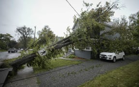
More than 200,000 homes and businesses were without power in Florida midday on Wednesday, Governor Ron DeSantis said, adding that number was a "drop in the bucket to what's going to happen in the next 24-48 hours".
Earlier this week, authorities told more than 2.5 million residents to evacuate. Doug Toe of Venice was one of those residents who chose to ignore warnings and stay put. As he walked through rainfall on Wednesday morning to see how a friend's home was weathering the storm, Toe admitted to never experiencing a storm of this magnitude, but he was unfazed by the prospects of it ravaging his neighbourhood.
"You have to be vigilant because you never know what's going to happen with it," he said. "I'm staying vigilant, but trying not to worry."
Major #surge destruction and water getting higher. .Naples beach area. #hurricaneian pic.twitter.com/IFKJNttcmv
— Warren Faidley (@Stormchaser) September 28, 2022
Hotels along Interstate Highway 75, which runs up and down Florida's west coast, were jam packed with people seeking shelter. This area is dotted with mobile home parks, which most residents had abandoned, taking refuge in local schools and other facilities being used as emergency shelters. The area's numerous assisted-living facilities were mostly evacuated, too.
Heartis Venice, an assisted living home north of Venice, was an exception. Of its 107 residents, 98 decided to shelter in place and continue receiving care with the help of staff and some family members, general manager Michelle Barger said. The facility, opened two years ago, was built to withstand a Category 5 storm.
The facility had stocked up on enough food and water to last more than seven days, as well as all medications and supplies needed to provide services, Barger said.
"Our community is locked down. We're secure and we're prepared for this," she said. "We feel pretty confident and safe, as do the residents and families and team members here."
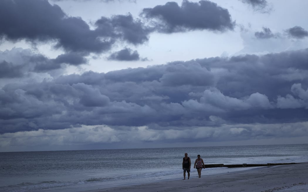
Storm clouds gather in advance of the hurricane's arrival in Treasure Island, Florida. Photo: WIN MCNAMEE / AFP
Warming planet
Climate change is making hurricanes wetter, windier and more intense. There is also evidence that it is causing storms to travel more slowly, meaning they can dump more water in one place, scientists say.
"Hurricane Ian's rapid intensification could prove to be another example of how a warming planet is changing hurricanes," said Kait Parker, meteorologist and climate scientist at IBM's weather.com. "Research shows we are seeing this far more often than we did in decades past."
Overnight and into Wednesday morning, Hurricane Ian pounded the Florida Keys island chain to the southernmost shores of the state's Gulf Coast with heavy rains showers and winds gusts, the NWS reported.
On Tuesday, the storm thrashed Cuba, knocking out the electrical grid for 11 million people and ravaging the western end of the island with violent winds and flooding. By early Wednesday, the state electricity provider said it had begun to restore power across the eastern end of the island.
-Reuters