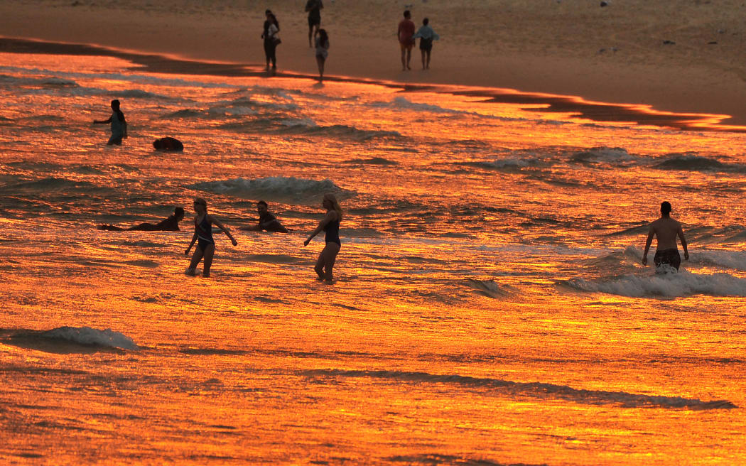
Beachgoers enjoy the sunset at Bondi beach during a heatwave in Sydney on December 19, 2019. Photo: AFP / Farooq Khan
By meteorologist Tom Saunders from the ABC
Without a doubt the one topic nearly every Australian will discuss this weekend is the weather - from a severe heatwave across New South Wales to intense rain and flooding in South Australia, to Tropical Cyclone Jasper accelerating towards the Queensland coast.
Also thrown into the conversation will be a cold, rainy Melbourne, a stormy Darwin and extreme fire danger around Perth.
Lets start the discussion with a numbers game:
- Sydney suburbs will sweat through the hottest weather in nearly four years on Saturday reaching up to 44 degrees Celsius.
- Melbourne's temperature through Saturday afternoon will be about 25C below Sydney's.
- Western NSW will extend its spell of mid 40s maximums to six days by Sunday.
- Adelaide could see double its December average rain in just over 24 hours.
- Eyre Peninsula could receive more than 100 millimetres of rain and break December records.
- Tropical Cyclone Jasper will halve its distance from the coast and position itself for its ultimate destination.
NSW bakes, when will relief arrive?
Temperatures today will soar as much 15 degrees above average across NSW and for many regions, including Sydney, maximums will reach the highest levels in three to four years.
Freshening winds and relatively low humidity will combine with Saturday's heat to raise fire dangers to extreme in a handful of regions, including Greater Sydney, meaning if fires do start, they will be fast moving and difficult to control.
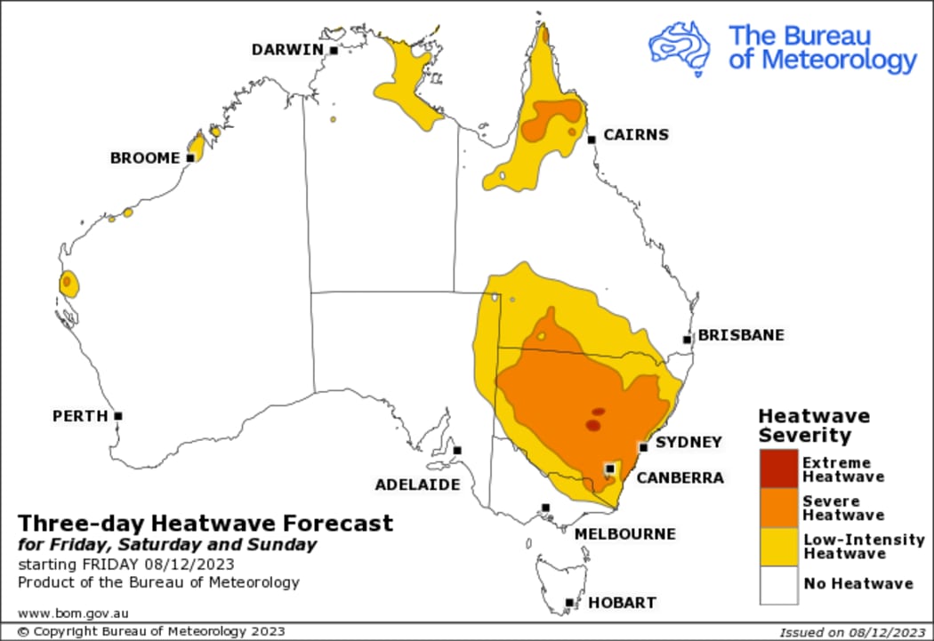
A three-day heatwave forecast for Australia. Photo: Australian Bureau of Meteorology
So when will a welcome change bring relief from the stifling conditions?
A cool southerly change has already swept through Victoria overnight and is now moving up the state's South Coast.
The gusty change will reach the Illawarra late afternoon and reach buster strength, leading to a rapid temperature drop of more than 15 degrees in two hours along with gusts in excess of 60km /hr.
The change should reach Sydney in the early evening and drop temperatures to the low twenties within hours while also triggering a fast moving shower or storm.
By midnight, relief should reach Newcastle.
However, the change will stall on the Mid North Coast and fail to penetrate the ranges, leading to another scorching hot day in the mid-forties across western NSW on Sunday.
The run of hot days will then persist through the first half of the week across inland regions and even spread back to the coast on Thursday before a deeper cool change is able to push right across the state into Friday.
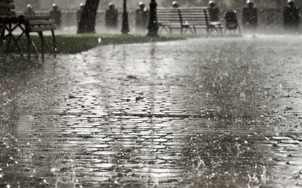
Record rain, flooding in SA
File photo. Photo: 123RF
South Australia only averages 18mm of rain in December, but the next 48 hours could bring more than 100mm to parts of Eyre Peninsula, while Adelaide can expect close to 50mm.
The unseasonable soaking is due to a very unusual weather pattern developing over this weekend - a pool of polar air will settle over the state and link with a river of tropical moisture to cause the widespread heavy rain.
The clash of summertime heat with polar air from Antarctica is leading to extreme conditions for the state - commencing with gales, intense heat, lightning and catastrophic fire dangers on Friday.
At one stage Woomera was 42C with 9 percent humidity and winds averaging 69 km/hr, enough for a fire danger of 188, nearly double the threshold of 100 for catastrophic in forested regions.
The heat will be replaced by the rain this weekend as the humid tropical air is lifted ahead of the cold air, and the result will be a rare summer drenching.
A flood watch has been issued for the Mt Lofy Ranges, Mid North and Eyre Peninsula in anticipation of the heavy rain this weekend, while a severe weather warning for flash flooding is also likely.
Cyclone Jasper edges towards coast
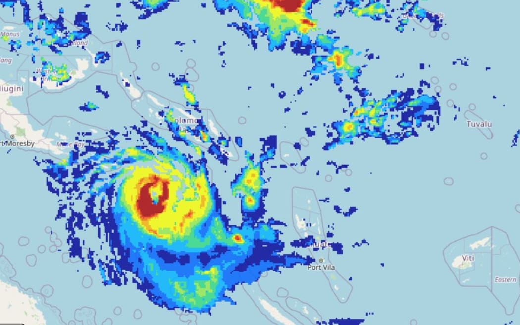
Tropical Cyclone Jasper Photo: The Solomon Islands Meteorological Service
Only three tropical cyclones have struck Queensland's east coast in December since 1970, but that number is looking increasingly likely to rise.
Cyclone Jasper is slowly but surely nearing the coastline and modelling is now firming up on the likely target of landfall - the North Tropical Coast from Cooktown to Townsville.
It's still too early to forecast precise impacts but if a major cyclone does reach the coast, then the following severe weather can be expected:
- Heavy rain and flooding - the systems should produce hundreds of millimetres of rain regardless of category.
- Destructive winds - unlike rain, the damage from wind is heavily reliant on the intensity of the system, but a Category 3 or above has the potential to cause roof and structural damage, power failures along with significant damage to crops and vegetation.
- Storm surge - can be the most devastating hazard, particularly just to the south of the eye where winds are onshore and the sea rises up well above the normal highest tide of the year.
- This story was first published by the ABC