

Dr Pete Russell is a storm chaser.
But that doesn’t mean he’s driving new-fangled-looking machinery into the path of tornadoes or sailing ships to intercept hurricanes.
He chases storms from his shared office in the marine science department at the University of Otago.

Dr Pete Russell. Photo: Claire Concannon / RNZ
Follow Our Changing World on Apple Podcasts, Spotify, Stitcher, iHeartRADIO, Google Podcasts, RadioPublic or wherever you listen to your podcasts
For the past seven years, Pete has been keeping tabs on tropical cyclones in the South Pacific via storm track data and satellite pictures. He is looking for a particular type of tropical cyclone – those that result in phytoplankton blooms.
Tropical cyclones can only form over warm water that is at least 26.5℃ for the first 50m. Spurred on by some disturbance, warm moist air rises off the ocean. As it rises, it cools, and the water vapour condenses into liquid droplets that form big clouds. The rising air leaves an area of low pressure, so wind comes in from the side to fill this, which in turn warms and rises. This sets up a positive feedback loop where the cyclone continues to ‘feed and grow’ off the warm water it travels over.
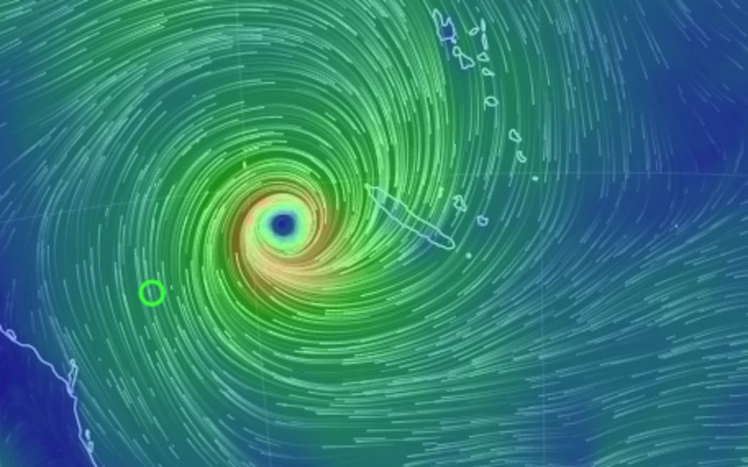
Cyclone Oma at midday on February 20, 2019 Photo: earth.nullschool.net/
The winds whipped up by a tropical cyclone will disturb the temperature layering of the ocean. This means if it were to hover for long in one position, the cyclone would essentially put itself out by pulling up colder water.
If it tracks in one direction, the disturbance at the front of the cyclone is reversed by the tail end – as the winds will blow in opposite directions.
But if the cyclone hovers for a while, and changes direction, then it might cause a large amount of colder water to be pulled to the surface in its wake. This cooler water from further down in the ocean column contains nutrients, and when the storm passes on and sunlight hits this patch of cooler water, it can lead to large phytoplankton blooms.
By looking at storm track data that shows the path of tropical cyclones Pete can predict whether they will result in a phytoplankton bloom. Satellite images of ocean colour, tuned to the chlorophyll A in phytoplankton, can then confirm this.
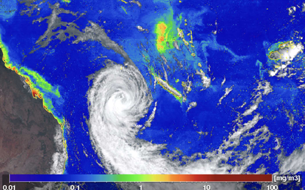
Scientists found that Cyclone Oma left phytoplankton blooms in its wake – a very rare event. Photo: P-Tree System, Japan Aerospace Exploration Agency (JAXA).
Listen to the episode to learn about one particularly large bloom event in 2019, and how these blooming cyclones might be the key to us predicting the future of tropical cyclones in a warmer South Pacific Ocean.
The stormy Southern Ocean
While Dr Pete Russell uses storm tracks and satellite data to do his work, there are a number of scientists around the world relying on data coming from marine buoys to do theirs.
And New Zealand is doing its bit to facilitate this.
In February the HMNZS Canterbury sailed to Campbell Island for Operation Endurance. Part of the objectives included deploying an anchored wave buoy for researchers around the world to be able to access good quality wave data from deep in the Southern Ocean.
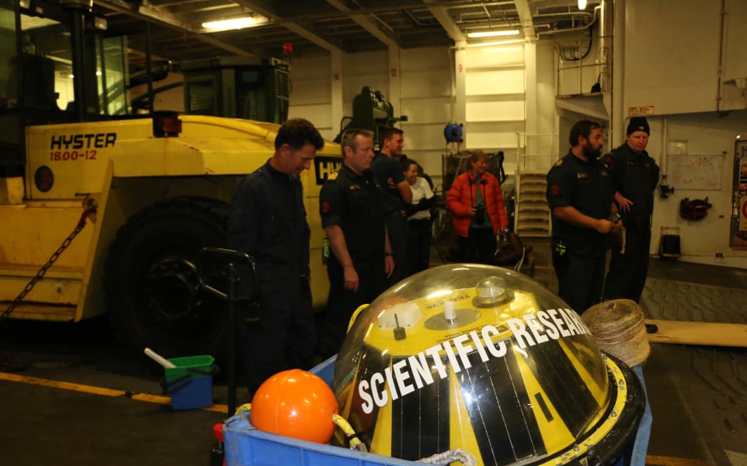
A wave buoy deployed from the HMNZS Canterbury during Operation Endurance to capture wave data in the Southern Ocean. Photo: Claire Concannon / RNZ
But science at sea is a tricky endeavour. Listen to the episode to learn about how the buoy works, how it was deployed, and how it is doing now.
To learn more:
-
Read the paper Extreme South Pacific Phytoplankton Blooms Induced by Tropical Cyclones
-
Listen to the episode When plans change to hear more about Operation Endurance

