
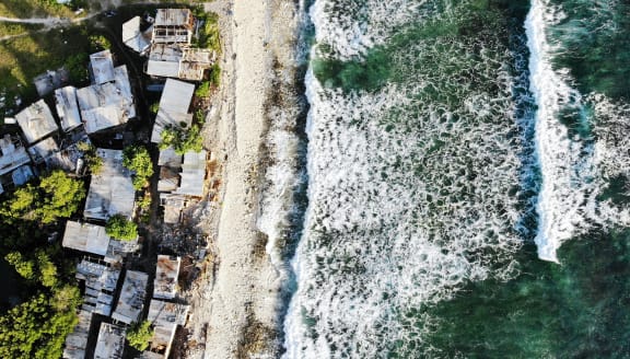
Coastal homes in Tuvalu, Funafuti pictured on November 28, 2019. The low-lying South Pacific island nation of about 11,000 people has been classified as "extremely vulnerable" to climate change by the United Nations Development Programme due to rising sea levels. Photo: Mario Tama/Getty Images
Computerised geo-graphical data or geo data is playing a crucial role in helping low-lying Pacific Island nations adapt to the impacts of climate change.
In Tuvalu, one of the world's most vulnerable island nations, a coastal adaptation project is developing innovative coastal protection solutions.
Implemented by the United Nations Development Programme and in partnership with the Tuvalu Government, geo-data specialists Fugro has leveraged airborne 'LiDAR' (Light Detection and Ranging) technology to capture precise coastal data - supporting adaptation planning for the future.
RNZ Pacific Editor Koroi Hawkins spoke with Fugro Asia Pacific director for hydrography and coastal reslience, Paul Seaton, who says understanding and combatting the risks associated with climate change and sea level rise requires a comprehensive baseline understanding and effective long-term monitoring of coastlines.

