
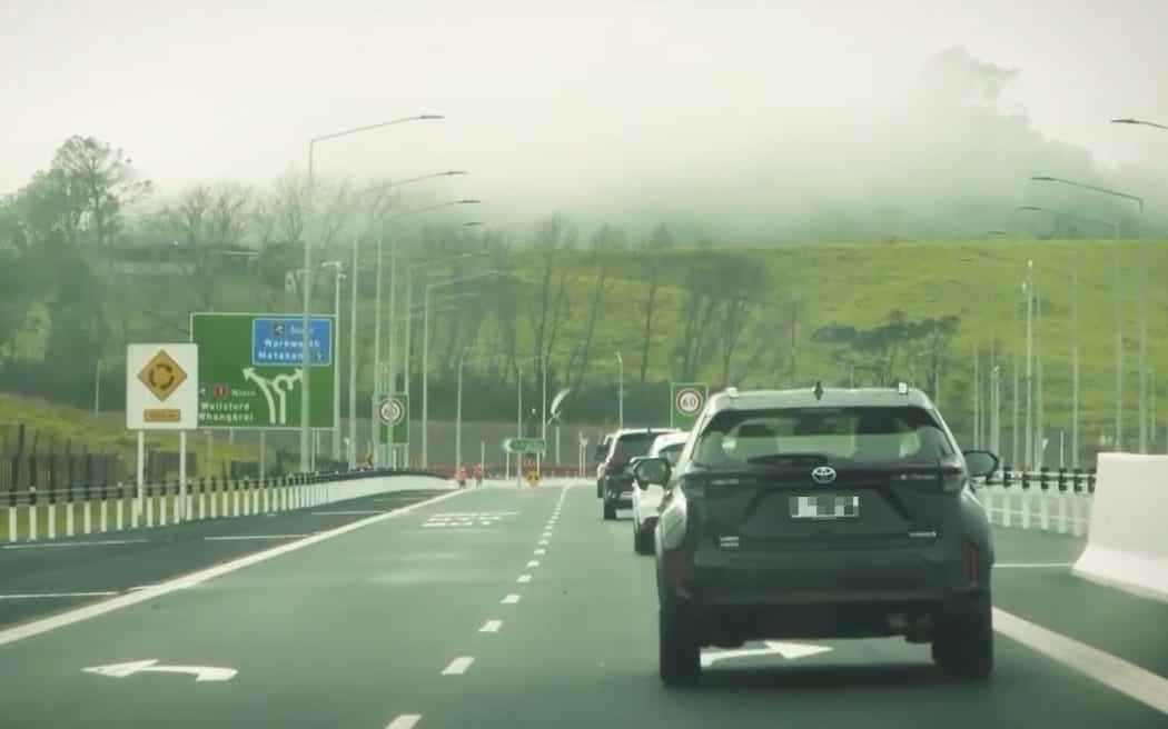
Waka Kotahi insists the Pūhoi to Warkworth motorway is built to last despite a major slip. Photo: Screenshot / RNZ
Waka Kotahi insists the country's newest road is built to last despite a major slip, but a geotechnical engineer warns the gullies in the area all look unstable and landslides are a normal occurrence.
Engineers are working to stabilise the slow slide of a slope at the north end of the Pūhoi-to-Warkworth motorway, hailed by the prime minister at its opening last month as the "more resilient and more reliable" way north.
Reports released to RNZ show many landslides and many repairs of them - adequate ones, a 300-page geotechnical report said - along the entire length of the 18.5km motorway.
Those occurred during the building of a road, at a time when Waka Kotahi admits that resilience was "not yet factored into decision-making" despite growing threats from climate change.
Yet it was "absolutely confident" in the motorway's resilience, the agency said on Checkpoint on Tuesday.
The repair job underway now was so low risk and so safe, they had started it even while opening the road, group general manager of transport services Brett Gliddon said.
Asked if they would never have to patch the landslip site again, Gliddon said "correct, that's the purpose of the fix".
However, NZTA has a track record of talking up new roads, then having to go back and fix them, expensively, such as on the Waikato and Kāpiti expressways, or arguing with contractors over extra costs and overruns such as at Transmission Gully which, like Pūhoi, was a public-private partnership (PPP).
So far the extra cost at Pūhoi looks limited to a few million. The next storm might change that.
Read the document: Pūhoi to Warkworth N1A Remediation Options Technical Memo (6MB)
The motorway is designed to last 100 years but reports obtained through an Official Information Act request revealed that heavy rains in July 2022 and January and February this year set off new slips.
The repairs themselves came with a caveat in the report: "It is therefore considered that the risk of future landslides at the locations of the existing landslides is lower due to the peer review and completed remedial works. Nevertheless, at some cut locations further landslides occurred despite a remedial work design [that] was in place."
A warning of what was to come was sounded by a local geotechnical engineer.
"The gullies in this area all look unstable," David Buxton of Whangārei's Northland Geotechnical Specialists said.
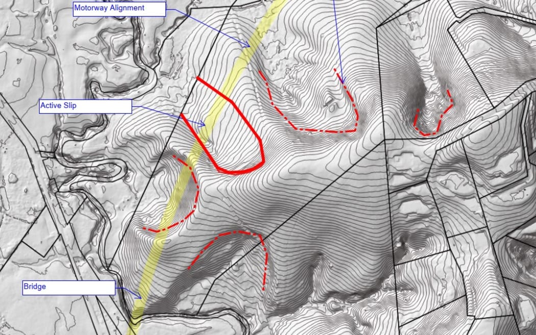
A terrain shaded GIS model picture showing the slip location near Warkworth. Engineer David Buxton said the gullies all looked unstable. Photo: Supplied
The slip site was "readily identifiable as suspicious" from contour maps.
"There are weak layers lurking in the underlying rock that are very low strength and ... landslides are a normal occurrence," he said.
As for pushing the highway on to Wellsford in the next phase, it "doesn't get any easier when you head north - indeed if they do the next section there will be many areas that are much worse".
Gliddon defended their pre-build investigations.
A half dozen engineers and project managers told RNZ the number of landslides during the project - at least 30 - was not necessarily unusual, and what mattered was their scale and nature.
The 300-page report goes into a lot of detail about that, eventually rating just 15 percent of cut slopes at between moderate risk and low-to-moderate, and the rest lower.
However, construction was not up to scratch on some of the slopes to start with, it said. Engineers looked at cut slopes and found cases of:
- slope stability at 1.3, instead of the required 1.5.
- soil slopes above rock cuts constructed steeper than required.
- bench widths above rock cuts narrower than the 4m required.
- drains not built to design.
The slope sliding near Warkworth moved up to 40cm in six months last year, then sped up. Another slope further south near Moir Hill Bridge moved up to 1.9m in a few months.
Read an excerpt from the 300-page geotechnical review here (687KB)
The road had "robust quality controls" and would be durable, Gliddon said in a statement to RNZ.
The project director for the NX2 consortium at Pūhoi, Robert Jones, said they knew about the slip near Warkworth for some time, and dealing with landslides was just a fact of life.
"It isn't something that surprised or particularly concerned us," said Jones, who retired last month.
Gliddon said the landscape had a history of slips and the road was designed and built to cope.
It "demonstrated its resilience in contrast to existing roads in the region" during Cyclone Gabrielle, he said.
The long geotechnical report last updated in April this year, had let them identify risks and fix them.
NX2 was responsible to meet quality standards and maintain the road under the PPP for the next 25 years, and it, not taxpayers, would pay to fix the landslide. The repair job was using engineered buttress fill and drainage to alleviate water pressures under the slope, Gliddon said.