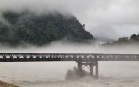
Mist and clouds hover over the area on the road to Franz Josef glacier on 19 January, 2024. Photo: RNZ / Tess Brunton
MetService says the West Coast is likely to see intense rain overnight, with an increased likelihood an orange heavy rain warning will be escalated to red by Wednesday morning.
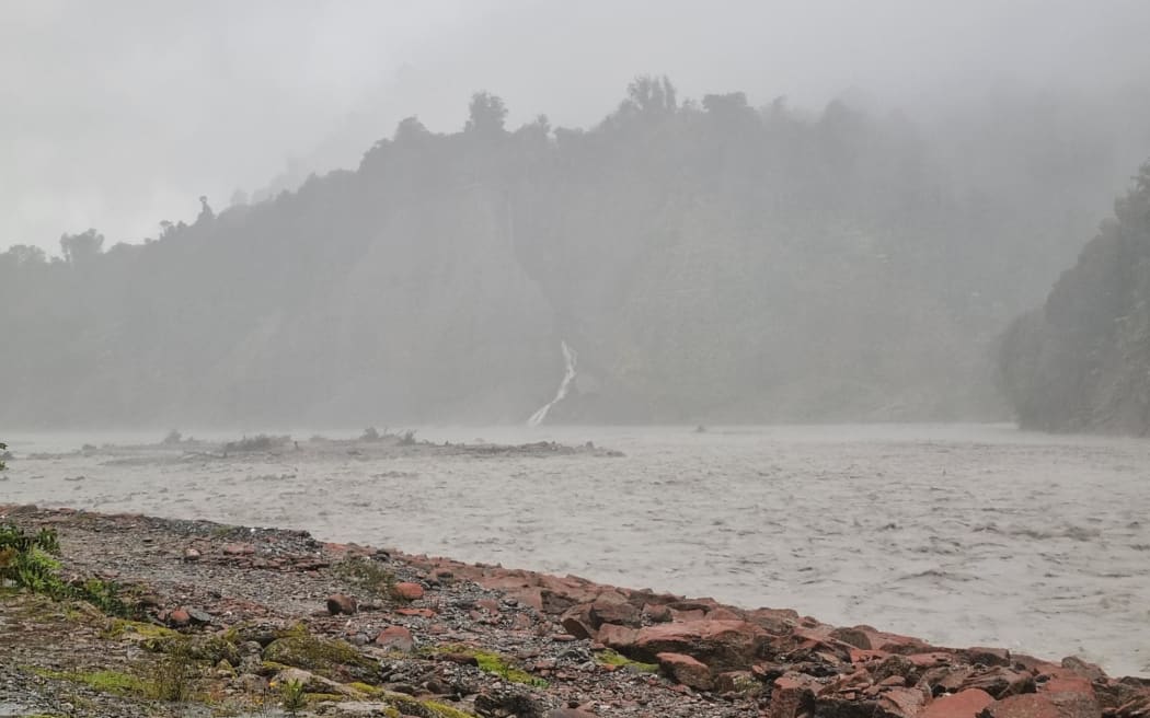
Up to 700mm of rain about the ranges and up to 250mm about the coast in the Westland District south of Hokitika was forecast on top of what had already fallen, the weather agency's Tuesday evening forecast said.
Red weather warnings are only used for the most severe storms, such as Cyclone Gabrielle in 2023.
The heavy rain might cause streams and rivers to rise rapidly and driving conditions might become hazardous with potential surface flooding and slips, MetService said.
As of Tuesday night, Fiordland was under an orange level heavy rain warning, with up to 80mm of rain forecast on top of what had already fallen.
When and where can the heaviest rain be expected?
— MetService (@MetService) April 9, 2024
We've broken it down here for you
Be sure to stay up to date with the latest at https://t.co/qHyE5zzql5@WakaKotahiCWC @NZcivildefence pic.twitter.com/7Mwg8pGwSm
Orange level rain warnings are also in place for the Canterbury High Country, where up to 500mm about the main divide and up to 250mm 15km further east are forecast, and to the Southern Lakes, where up to 100mm about the main divide and up to 100mm 15km further east.
Meteorologist Gerard Bellam said it was a significant amount of heavy rain for Westland and up to 400mm could fall from 9.30pm Tuesday until midday Wednesday.
At least 80mm of rain has already fallen on Westland in nine hours between noon and 9pm Tuesday.
"There's going to be an intense period of rain overnight Tuesday and Wednesday morning. There will be further heavy rain during the remainder of Wednesday but it won't be so intense, but the intensity of the rain is expected to increase again on Thursday."
State Highway 6 between Haast and Fox Glacier was closed on Tuesday evening due to a slip.
Waka Kotahi NZTA said people should delay their journeys because there was no detour available and SH6 would remain closed overnight and be reassessed in the morning.
Earlier on Tuesday, NZTA said motorists should plan ahead and check the latest conditions before driving on the West Coast, because the forecast rain could impact parts of the state highway network, including the possibility of surface flooding and debris on road surfaces.
The band of rain will move north & south over the next two days, as shown by the rolling one hour rainfall forecast.
— NIWA Weather (@NiwaWeather) April 9, 2024
Rain will likely expand into a larger area from Thursday morning.
From then, we'll need to also watch the upper & lower part of the South Island for impacts. pic.twitter.com/hUY71rnyN0
On Tuesday evening, West Coast Emergency Management said rain was settling in the district and there was some surface flooding around.
It would continue to monitor throughout the night and expected raised river levels to go through alarms, it said.
West Coast Emergency Management advised people not to take any chances and to act quickly if they saw rising flood waters, because floods and flash floods could happen quickly.